Landslides – Geological Survey Planned Around Bhakra Dam
Landslides – The Geological Survey of India is expected to conduct an in-depth scientific study of the hill slopes surrounding the Bhakra Dam as authorities move to strengthen safety measures ahead of future monsoon seasons.
Amid recurring landslides in recent years, the Geological Survey of India is likely to undertake a detailed geological assessment of the hillocks encircling the Bhakra Dam. The move comes as part of a precautionary strategy being prepared by the Bhakra Beas Management Board, which oversees the dam’s operations and related infrastructure.
Proposed Agreement for Comprehensive Geological Study
Officials familiar with the development said the Board is in the process of finalising a Memorandum of Understanding with the Geological Survey of India to formally commission the study. Communication between the two agencies has already taken place, and procedural steps to sign the agreement are underway.
The proposed survey will focus on examining the structural integrity of rocks, assessing slope stability, identifying potential fault lines and analysing natural drainage patterns in the region. Authorities plan to use the findings to determine whether additional protective steps are required to reinforce vulnerable stretches around the dam and nearby facilities.
According to sources, the initiative is not linked to any immediate structural danger to the dam. Instead, it is intended as a forward-looking safety exercise designed to obtain expert advice on modern stabilisation techniques. These may include rock bolting, construction of retaining walls, improved water drainage systems and bio-engineering solutions aimed at reducing soil erosion.
Fragile Terrain and Monsoon Vulnerability
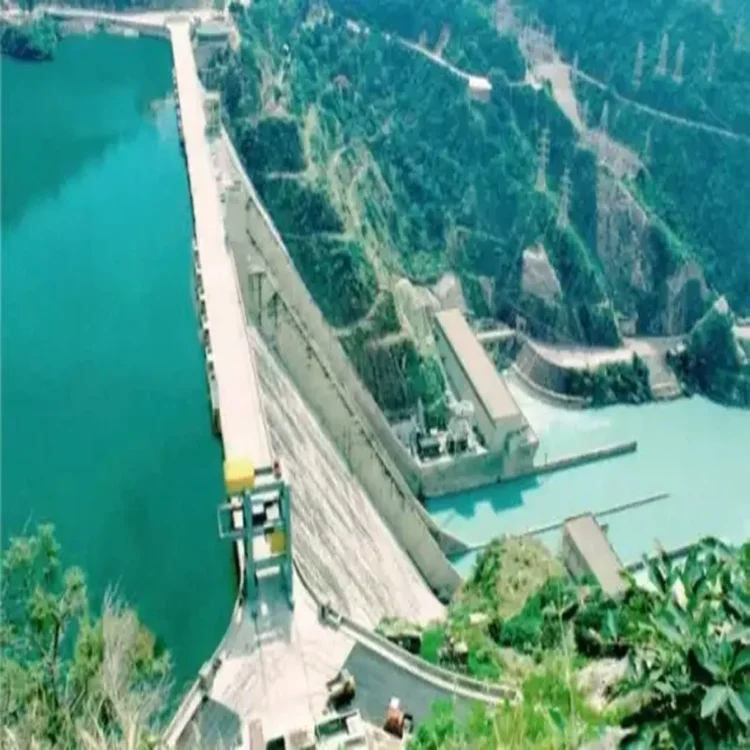
The hill formations surrounding the dam largely consist of sedimentary and metamorphic rocks. Such geological compositions are often susceptible to weathering, especially in regions exposed to sustained rainfall. The broader Shivalik belt, where the dam is located, has long been recognised for its fragile slopes and loose surface material that can easily shift under stress.
Over the past few monsoon seasons, several incidents of slope failure have been reported in the area. Intense rainfall has triggered landslides not only near the dam site but also along key approach routes from Nangal. These disruptions have underlined the need for a scientific reassessment of the terrain’s stability.
Past Disruptions Prompt Preventive Planning
Last year, heavy rains led to multiple landslides that blocked roadways and railway tracks connecting Nangal to the dam complex. The temporary closures affected the movement of staff and delayed the transport of essential materials required for routine operations.
In one instance, debris from nearby slopes entered parts of the powerhouse complex. Officials said the situation was brought under control in time, preventing any major operational setback. However, the incidents highlighted the potential risks posed by unstable hill slopes during periods of intense precipitation.
Experts note that rising rainfall intensity in several parts of northern India has increased the pressure on infrastructure located in hilly terrain. In such regions, slope instability can be triggered by a combination of heavy rainfall, minor seismic activity and human interventions such as construction or excavation.
Strategic Importance of the Structure
The Bhakra Dam, standing approximately 226 metres tall, is among the tallest gravity dams in the country. It forms the vast Gobind Sagar reservoir and plays a crucial role in hydroelectric power generation, irrigation and water supply across multiple states.
Given its strategic and economic importance, authorities are prioritising long-term safety planning. The upcoming geological study is expected to provide updated scientific data that can guide targeted interventions, ensuring that the dam and its supporting infrastructure remain secure against evolving environmental challenges.