
Flooding – Severe Rainfall Raises Disaster Concerns Across Southern Japan
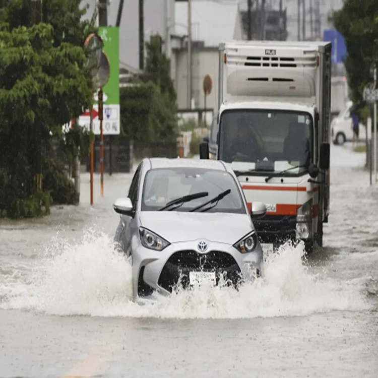
Flooding – Authorities in Japan have issued fresh warnings as intense rainfall continues to affect large parts of the country’s southwest, increasing concerns over flooding and landslides in several regions. Residents living in vulnerable areas have been advised to closely monitor official updates and take precautionary measures as weather conditions remain unstable.
Weather Agency Issues Urgent Advisory
Japan’s national weather authorities reported on Wednesday that persistent downpours were creating a rapidly growing threat of natural disasters across the Kyushu region. Officials stressed that the combination of saturated ground conditions and ongoing rainfall could significantly increase the likelihood of landslides and flood-related incidents.
Local administrations have encouraged communities to remain alert, particularly those living near hillsides, rivers, and low-lying locations. Emergency preparedness measures are being emphasized as the weather system continues to develop.
Intense Rainfall Recorded in Multiple Prefectures
According to data released by the Japan Meteorological Agency (JMA), exceptionally heavy rain was recorded during the early hours of Wednesday in parts of Nagasaki Prefecture, where rainfall intensity exceeded 50 millimeters per hour.
Further south, Satsumasendai City in Kagoshima Prefecture experienced one of the highest rainfall readings, with 70.5 millimeters falling within a single hour by 8:30 a.m. local time. Meanwhile, some areas of Kumamoto Prefecture registered around 40 millimeters of rainfall during the same period.
Meteorologists noted that these figures reflect the strength of the weather system currently influencing southwestern Japan and highlight the possibility of further disruptions if rainfall continues at a similar pace.
Significant Rainfall Expected Through Thursday
Forecast models indicate that northern Kyushu could receive approximately 200 millimeters of rainfall during the 24-hour period ending at 6 a.m. on Thursday. Weather experts attribute the prolonged wet conditions to the interaction between a seasonal rain front and a nearby low-pressure system.
The combination of these atmospheric factors is expected to generate widespread heavy showers and thunderstorms across several prefectures. Authorities are monitoring the situation closely as river levels and soil moisture continue to rise.
Shikoku Also Faces Elevated Weather Risks
Beyond Kyushu, the island of Shikoku is also expected to experience substantial rainfall. Current forecasts suggest cumulative precipitation totals may reach around 250 millimeters within the same 24-hour period.
Forecasters cautioned that localized weather patterns could produce even heavier rainfall in some districts than current estimates suggest. Areas affected by concentrated rain systems may face heightened risks of flooding and transportation disruptions.
Linear Rainband Alert Issued
The Japan Meteorological Agency has issued a specific alert for the Satsuma area of Kagoshima Prefecture due to the possibility of linear rainbands developing over the region. These weather formations can bring prolonged periods of intense rainfall over the same location, rapidly increasing the danger of flash flooding and slope failures.
Officials warned that continued heavy rain could quickly worsen conditions, urging residents to stay informed through official channels and follow evacuation guidance if necessary. Emergency services remain on standby as authorities work to minimize potential impacts from the severe weather event