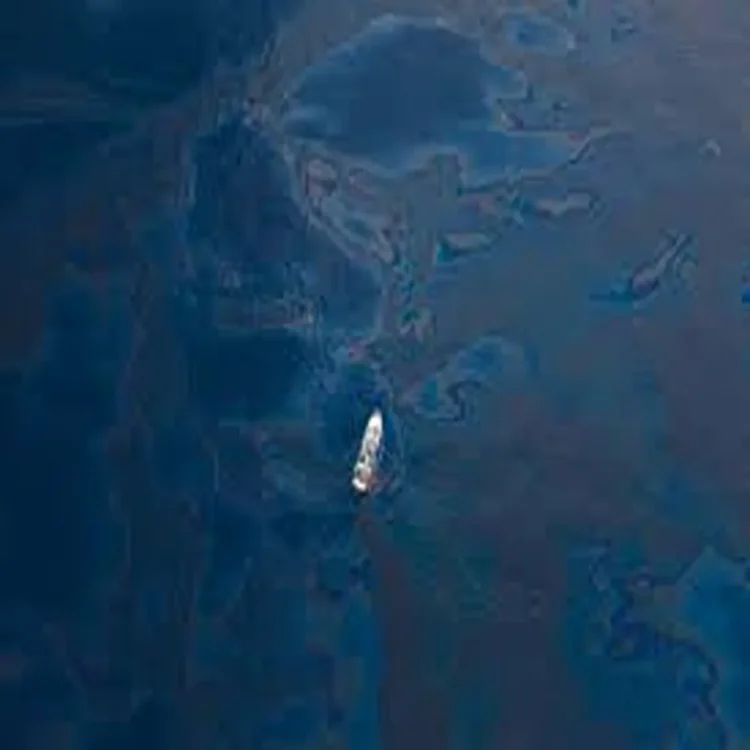
OilSpill – Gulf of Mexico spill spreads widely across protected zones
OilSpill – An extensive oil spill detected in early March across the Gulf of Mexico has stretched over 600 kilometers, reaching multiple ecologically sensitive zones, according to Mexican authorities. Initial findings suggest that the contamination originated from a combination of an unidentified vessel and naturally occurring oil seepage points beneath the seabed. Officials have stated that, despite the scale, there is currently no evidence pointing to catastrophic environmental damage.
Investigation identifies multiple sources
Mexican Navy officials revealed that satellite imagery and on-site inspections helped trace the spill to three likely sources. One of these includes a vessel anchored near the port city of Coatzacoalcos in Veracruz. However, authorities have yet to determine the exact ship responsible, as at least 13 vessels were operating in the vicinity during the relevant period and have not all been examined.
In addition to the vessel, two natural oil seepage sites were identified. One lies approximately eight kilometers from Coatzacoalcos, while the other is located in the Bay of Campeche. These seepages, known locally for their continuous emissions, have reportedly shown increased activity in recent weeks.
Ongoing leakage raises concerns
Admiral Raymundo Morales acknowledged that the spill is still active, with natural seepage in the Cantarell region contributing significantly to the ongoing release of hydrocarbons. While such seepage is a regular geological phenomenon, officials noted an unusual surge in discharge levels over the past month, which may have worsened the situation.
Authorities also referenced a previous incident in Veracruz five months earlier, when heavy rainfall caused a pipeline rupture that polluted the Pantepec River over an eight-kilometer stretch. Although unrelated, the earlier spill has heightened scrutiny on infrastructure and environmental safeguards in the region.
Scale of contamination and cleanup efforts
The affected area from the March spill spans roughly 600 kilometers, including around 200 kilometers of coastline across Veracruz and Tabasco. Environmental teams have so far recovered approximately 430 tons of hydrocarbons from the impacted zones.
Cleanup operations have been carried out across several protected areas, including the Los Tuxtlas Biosphere Reserve and the Veracruz Reef System National Park. Additional sites such as the Lechuguillas Sanctuary, Totonacapan Beaches Sanctuary, and the Lobos Tuxpan Reef System have also reported contamination. Efforts have extended into Tabasco’s Centla Wetlands Biosphere Reserve as well.
Impact on wildlife and ecosystems
Mexico’s environmental authorities confirmed that at least six species have been affected, including marine turtles, fish, and various bird species. While officials maintain that the damage is not severe, conservation groups have raised concerns about the broader ecological consequences.
The National Commission of Natural Protected Areas reported hydrocarbon presence in multiple sensitive habitats, prompting coordinated cleanup measures. Meanwhile, ocean conservation organization Oceana cited reports from local communities indicating more serious impacts, including the deaths of marine animals such as sea turtles and a manatee, along with damage to several coral reef systems.
Transparency concerns and next steps
The release of preliminary findings comes after weeks of public criticism regarding limited transparency in handling the incident. Authorities have pledged to continue investigations, particularly to identify the vessel suspected to be one of the primary contributors.
Monitoring of affected areas remains ongoing, with officials emphasizing the importance of balancing industrial activity with environmental protection in the Gulf region. Further updates are expected as inspections continue and more data becomes available.