Earthquake – NASA Satellite Assessment Reveals Widespread Building Damage Across Venezuela
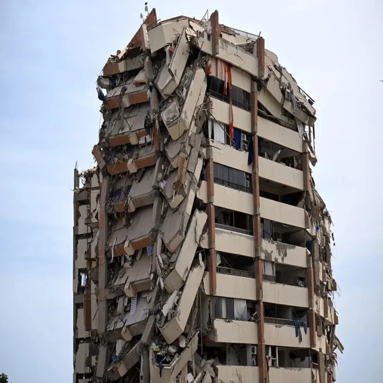
Earthquake – Venezuela is continuing to measure the devastating consequences of the twin earthquakes that struck the country last week, with fresh satellite-based findings indicating that tens of thousands of buildings may have suffered severe structural damage.
NASA Analysis Highlights Scale of Destruction
A preliminary damage assessment released by the US space agency NASA suggests that nearly 58,870 buildings across the affected regions were either damaged or completely destroyed after the powerful earthquakes. The estimate is based on satellite radar observations collected on June 25, one day after the disaster, offering one of the earliest large-scale evaluations of the destruction.
The assessment was prepared by researchers Corey Scher and Jamon Van Den Hoek of Oregon State University using high-resolution radar imagery from the European Space Agency’s Sentinel-1 satellite. The scientists emphasized that the findings represent a rapid analysis of surface changes detected from space and should not be considered a final verified count.
Ground Verification Still Underway
According to the researchers, the satellite data identifies sudden changes in the landscape that are consistent with earthquake-related damage. However, they cautioned that the results remain preliminary because extensive field inspections have not yet been completed.
Officials and emergency teams continue to carry out on-the-ground surveys in the worst-hit communities, where access remains difficult due to damaged roads, collapsed structures, and disrupted communication networks.
Casualties and Missing Persons Remain a Major Concern
The twin earthquakes, measuring magnitudes of 7.2 and 7.5, are considered the strongest seismic events to strike Venezuela in more than a century. The disaster has claimed around 1,700 lives, while thousands of people are still reported missing as rescue operations continue across several affected areas.
Search and recovery teams remain engaged in efforts to locate survivors and account for missing residents. Authorities have also been working to provide temporary shelter, emergency medical care, and essential supplies to displaced families.
Government Releases Structural Damage Update
National Assembly President Jorge Rodriguez said on Monday that official inspections have so far identified damage to 855 buildings. Among those, 189 structures were classified as total collapses, highlighting the serious impact on homes, public facilities, and other infrastructure.
Officials noted that these numbers are expected to change as assessment teams reach additional locations and complete more detailed inspections. Many remote communities remain difficult to access, slowing the verification process.
Satellite Technology Supports Emergency Response
NASA stated that its Earth-observing satellites are playing an important role in supporting disaster response efforts. The agency said the imagery and scientific data being collected are helping emergency responders understand the extent of the destruction, prioritize rescue operations, and guide recovery planning.
Satellite observations have become an essential tool during major natural disasters, particularly when conditions on the ground make immediate inspections challenging. The information allows authorities and humanitarian organizations to identify heavily affected areas more quickly and allocate resources where they are needed most.
As emergency operations continue, both satellite analysis and field investigations are expected to provide a clearer picture of the overall impact of one of the most destructive earthquakes Venezuela has experienced in recent history