
Waterlogging – Delhi Identifies 169 Flood-Prone Locations Before Monsoon Arrives
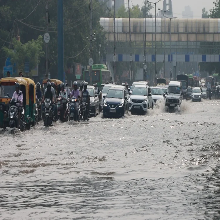
Waterlogging – The Delhi government has completed an extensive assessment of areas susceptible to water accumulation ahead of the monsoon season, identifying 169 locations across the national capital where recurring waterlogging has been recorded. According to the recently issued flood control order, several of these sites witnessed persistent flooding during 2025, prompting authorities to strengthen preparedness measures before heavy rainfall begins.
Ring Road and Underpasses Remain Key Areas of Concern
Among the identified locations, nearly 31 are situated along the busy Ring Road, making them a major focus for traffic and civic management during the rainy season. Officials have also listed nine underpasses as highly vulnerable to waterlogging. These include Minto Bridge, Zakhira, Dwarka, Moolchand, and Pul Prahlad Pur underpasses maintained by the Public Works Department (PWD), along with Ram Bagh, Okhla, Sarita Vihar, and Pandav Nagar underpasses, which are managed by other civic agencies.
To reduce the impact of flooding in these areas, the PWD has deployed temporary pumping equipment and introduced a standard operating procedure to ensure the quick removal of accumulated rainwater, particularly from underpasses where traffic disruptions are common.
Hundreds of Additional Locations Under Close Monitoring
Apart from the officially identified flood-prone sites, authorities are keeping watch on 445 additional waterlogging hotspots. These locations have been mapped using traffic police records collected over 2023, 2024, and 2025. Officials said continuous monitoring will help agencies respond more efficiently and reduce disruptions caused by heavy rainfall.
Several important stretches around the ITO intersection continue to remain vulnerable. Areas near the Delhi Secretariat, Indira Gandhi Indoor Stadium, the PWD headquarters, the former police headquarters, Rajghat crossing, Bahadur Shah Zafar Marg, and the vicinity of Indraprastha Metro Station have all experienced repeated waterlogging in previous monsoon seasons.
Pragati Maidan Corridor Included in Flood Preparedness Plan
The road connecting Mathura Road to the main Pragati Maidan tunnel, along with the entrance from Purana Qila Road, has also been identified as a sensitive location. These stretches have experienced flooding on multiple occasions in recent years, often leading to traffic congestion and delays for commuters. Authorities have included these areas in their preventive action plan to improve water drainage during periods of intense rainfall.
Yamuna Water Levels to Guide Flood Response
The flood control order outlines a structured warning mechanism linked to water discharge from the Hathnikund Barrage. The first flood alert will be issued once the discharge exceeds one lakh cusecs, after which sector-level control rooms across Delhi will begin operations and closely monitor conditions in their respective jurisdictions.
The monitoring system specifies a warning level of 204.50 metres for the Yamuna, while the danger mark has been fixed at 205.33 metres. Evacuation measures will be considered if the river reaches 206 metres, ensuring that emergency response teams remain prepared in advance.
Drainage Network to Help Prevent Urban Flooding
As part of its flood management strategy, the Delhi government plans to operate 11 regulator drains to manage the discharge of stormwater into the Yamuna. Officials said the Old Railway Bridge will continue to serve as the primary reference point for tracking the river’s water level throughout the monsoon.
The regulator gates installed at the outlets of drains flowing into the Yamuna will be operated according to changing river conditions. During normal rainfall, these systems will help pump excess water out of the city. However, if the Yamuna experiences high flood levels because of heavy rainfall in Delhi or upstream regions, the gates will remain closed to prevent river water from flowing back into the city’s drainage network and worsening urban flooding.