ClimateRisk – Kashmir Himalayan Glacial Lakes Raise Flood Threat Concerns
ClimateRisk – A recent scientific assessment has raised serious concerns over the stability of several glacial lakes in the Kashmir Himalayas, identifying five of them as highly vulnerable to sudden and potentially destructive outburst floods. If such an event occurs, it could place thousands of structures and key infrastructure in danger, highlighting the growing risks linked to changing environmental conditions in the region.
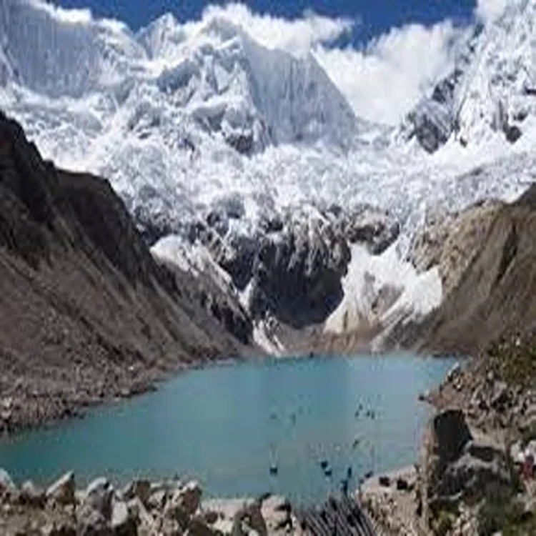
Study Identifies High-Risk Glacial Lakes
The analysis, carried out by researchers from the Department of Geoinformatics at the University of Kashmir, examined 155 glacial lakes using a range of hydro-geomorphic indicators. These indicators included how rapidly lakes are expanding, the structural integrity of natural barriers holding them in place, and surrounding environmental dynamics.
Based on this detailed evaluation, five lakes—Bramsar, Chirsar, Nundkok, Gangabal, and Bhagsar—were classified in the highest risk category. This designation means they are more likely than others to experience sudden water release under certain triggering conditions, such as heavy rainfall, ice avalanches, or seismic activity.
Potential Impact on Infrastructure and Settlements
The study also mapped areas downstream that could face significant exposure in the event of a glacial lake outburst. The findings suggest that approximately 2,704 buildings could be affected, along with around 15 major bridges and several stretches of road networks. Additionally, at least one hydropower project lies within the potential impact zone.
Such projections underline the scale of possible disruption, especially in mountainous regions where connectivity and infrastructure are already limited. Damage to bridges and roads could isolate communities, complicating rescue and relief efforts during emergencies.
Data Gaps Limit Precise Predictions
While the study provides an important overview, experts caution that accurately forecasting the magnitude and speed of such floods remains a challenge. One key limitation is the lack of detailed data on the volume and depth of these glacial lakes.
Without comprehensive bathymetric measurements—data that maps the underwater topography of lakes—it is difficult to model how much water could be released and how quickly it might travel downstream. This gap continues to hinder precise early warning capabilities.
New Technology to Strengthen Research
To address these challenges, authorities have initiated steps to improve scientific data collection. The Department of Geoinformatics has recently acquired a high-precision robotic echo-sounding boat equipped with RTK technology, funded by the Ministry of Earth Sciences.
This advanced equipment will be used to conduct detailed bathymetric surveys of vulnerable lakes in the western Himalayas starting in 2026. These surveys are expected to provide critical insights into lake depth and volume, which are essential for developing reliable flood models.
Strengthening Preparedness and Monitoring Systems
In parallel with research efforts, government agencies and scientific institutions are focusing on strengthening monitoring and preparedness systems. Continuous satellite-based observation of glacial lakes is being combined with targeted field studies to track changes more accurately.
Plans are also underway to install early warning systems in vulnerable regions. These systems aim to detect warning signs of potential outbursts and relay alerts in real time, allowing authorities and communities to respond more quickly.
Integrated Approach to Disaster Management
Authorities are working to incorporate glacial lake outburst flood scenarios into district-level disaster management plans. This includes developing eco-sensitive zoning regulations to restrict construction in high-risk downstream areas.
Researchers are also designing customized early warning mechanisms suited to mountainous terrain. These systems integrate satellite data, ground-based observations, weather sensors, and communication networks to ensure timely dissemination of alerts.
Such coordinated efforts are expected to improve risk assessment and strengthen disaster preparedness strategies, particularly in regions where climate change is accelerating environmental instability.