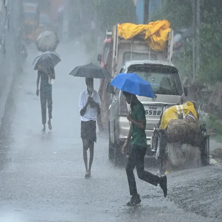
Weather – Moderate Rain Forecast Across Southern Tamil Nadu Till March 1
Weather – The Regional Meteorological Centre in Chennai has predicted spells of moderate rain in parts of southern Tamil Nadu and along the Western Ghats over the next few days. The outlook follows the development of a low-pressure system over the Bay of Bengal, which is expected to influence weather patterns across the region until March 1.
Low-Pressure System Forms Over Bay of Bengal
According to an official statement issued on February 23, a low-pressure area took shape over the southwest Bay of Bengal and nearby central parts of the sea during the morning hours. Meteorologists said the system is likely to drift gradually towards the northeast while weakening over time.
Although the system is not expected to intensify significantly, it is contributing to increased moisture and cloud formation over peninsular India. Weather officials noted that this development, combined with other atmospheric factors, will support rainfall activity in selected districts.
Cyclonic Circulation Adds to Weather Activity
In addition to the low-pressure area, a cyclonic circulation has been observed over the southeast Arabian Sea, off the south Kerala coast. This circulation is expected to enhance rainfall over adjoining land areas, particularly southern Tamil Nadu and districts situated along the Western Ghats.
Under the combined influence of these systems, moderate rain is forecast at one or two locations across southern districts from February 24 through March 1. Authorities have indicated that rainfall will be scattered rather than widespread, with varying intensity across districts.
Rainfall Figures From the Past 24 Hours
The weather department also shared precipitation data recorded during the previous 24 hours. Sankarankovil in Tenkasi district reported the highest rainfall in the state, receiving 40 mm.
Several other areas experienced steady showers. Perunchani Dam in Kanniyakumari district recorded 30 mm of rainfall, as did Sivalogam, Kuzhithurai, Surulacode, and Puthen Dam. These figures reflect localized but consistent rainfall across parts of the southern belt.
Locations that measured 20 mm of rainfall include Kayathar in Thoothukudi district, Palamore and Tirupathisaram in Kanniyakumari district, Chittar, Sivagiri in Thoothukudi, Kovilpatti, Thoothukudi town, and certain pockets of Madurai district. Officials said such rainfall levels are typical during weak low-pressure conditions in the Bay of Bengal.
Advisory Issued for Fishermen
Marine conditions are also expected to turn rough in parts of the Bay of Bengal. The department has cautioned that squally weather may affect the northern stretches of the southeast Bay of Bengal as well as adjoining southwest, central, and east-central areas of the sea.
Wind speeds in these regions could reach up to 60 kilometres per hour, creating challenging conditions for small fishing vessels. In view of this, fishermen have been strongly advised not to venture into the identified sea zones until conditions improve.
Authorities stressed that the advisory is precautionary and aimed at preventing accidents during unstable weather. Coastal communities have been asked to remain attentive to updates issued by the meteorological department.
Monitoring Continues as Rainfall Persists
Weather officials said they are closely tracking the progress of both the low-pressure system and the cyclonic circulation. Further updates will be released if there are any significant changes in intensity or movement.
With intermittent rain expected over the coming days, residents in southern Tamil Nadu districts have been advised to remain alert and plan activities accordingly. While no extreme weather warning has been issued, officials emphasised the importance of following official guidance, particularly for those engaged in marine and agricultural activities.